Big data has quickly become one of the most important resources for organizations in the modern world, providing insights into markets, products, and customer behavior. But big data is not only useful for understanding people; it can also be used to gain insight into our geospatial world.
By leveraging the power of big data, organizations can gain a better understanding of the physical world, and the relationships between different places and their inhabitants. Through the use of big data, organizations can develop detailed insights into the environment, its resources, and the people living in it.
This understanding allows organizations to make better-informed decisions, as they can more accurately assess the impact of their actions on the world around them. By leveraging big data, organizations can gain deeper insights into our geospatial world, allowing them to make more informed and effective decisions.
What is Big Data?
Big data refers to a large amount of data that organizations cannot process using standard techniques. As a result, the data must be processed using a specialized approach. This approach is typically more complex, time-consuming, and resource-intensive than standard data processing techniques.
Big data is generated from a variety of sources, including sensors, social media, the internet of things (IoT), and machine learning algorithms. As a result, big data is typically unstructured, and as it grows, it becomes increasingly difficult to manage.
Therefore, organizations must invest in advanced data management technologies, such as data lakes and predictive analytics software, to efficiently store and process data. There are a number of Big Data courses and certification options that can help you get up to speed.
Examples of how organizations can use big data for geospatial insights
Organizations can use big data for geospatial insights in a variety of ways:
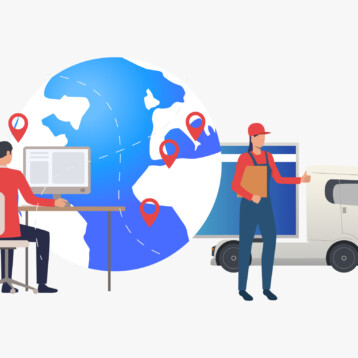
1. Customer Behavior: By leveraging the power of big data, organizations can gain valuable insights into how their customers interact with their products, services, and locations. Organizations can use geospatial analysis to better understand customer behaviors, track trends and patterns, and determine where to invest resources.
Big data can be used to provide predictive insights into consumer trends and preferences. By analyzing customer behavior, organizations can anticipate user needs and develop strategies to meet those needs in a timely manner. This information can be used to create personalization locational campaigns, adjust product offerings, and modify services in order to maximize customer satisfaction.
2. Internet of Things: Organizations can use big data for the Internet of Things (IoT) to improve their operations, increase efficiency, and gain competitive advantages. Big data can help organizations collect and analyze large amounts of data from IoT devices, providing insights into operations and customer behavior. By leveraging the data gathered from these devices, organizations can detect geospatial patterns and correlations that would otherwise be difficult to uncover. This data can then build inform decisions related to product development, process optimization, customer service, and more.
Additionally, big data can aid in predictive analytics, allowing organizations to anticipate potential problems or opportunities before they occur. For example, companies can monitor their supply chain in real-time and detect inefficiencies or delays before they become costly. Finally, big data can be a powerful tool for optimizing customer experiences. Companies can use location data gathered from IoT devices to understand customer behaviors and preferences, enabling them to create personalized offerings and services.
3. Environment: Big data can also help organizations gain a better understanding of the environment and its impact on their operations. By analyzing weather patterns, air quality, water quality, soil characteristics, and topography, organizations can more effectively plan for future growth and adaptation.
In addition, governments can use big data to identify areas of risk such as natural disasters, political instability, and other external factors that could affect their operations. By combining these insights with traditional risk management techniques, governments can make well-informed decisions about how to make informed decisions in areas like climate change.
Tools and technologies used for geospatial analysis
Big data platforms are the foundation of combining this incredibly large amount of data with geospatial analysis efforts. The most common platforms include Hadoop, Spark, and Amazon Web Services (AWS) Elastic MapReduce (EMR).
However, there are some new technologies specifically catered to geospatial analysis.
ArcGIS GeoAnalytics Server provides big data processing and analysis capabilities with data visualization capabilities. ArcGIS GeoAnalytics Server includes a distributed computing framework that supports a variety of analytics tools for processing large amounts of data.
Here are some of its main capabilities:
- Data Visualization – Data visualization in ArcGIS GeoAnalytics Server is used for creating visualizations to communicate insights. These tools can be helpful for creating visualizations related to the environment, such as visualizing sensor information. They can also be helpful for visualizing patterns related to human behavior, such as GPS tracking and the spread of disease.
- Geospatial Analysis Tools – Geospatial analysis tools are commonly used for more in-depth geospatial analysis. They are often used for more complex geospatial analysis tasks, such as creating predictive models and performing exploratory analysis with a geography component.
Conclusion
As organizations become increasingly dependent on data analysis and data analytics, they realize the importance of leveraging big data. Big data is a valuable resource that can provide organizations with insights into their operations, customers, and the environment around them. But it can be even more valuable when you add a geospatial component.
Big data analytics has the potential to provide organizations with a competitive advantage through the identification of trends and other patterns. However, businesses must take care to properly manage the data they collect and analyze.
In order to maximize the benefits of big data, organizations need to consider a number of best practices. These best practices include establishing a data governance policy, choosing the right data management solution, and ensuring the geospatial capabilities of big data.
Overall, big data is a valuable resource that can provide organizations with insights into their operations, customers, and the environment around them. But big data geospatial analytics has the potential to provide organizations with a competitive advantage through the identification of trends and other patterns with a focus on geography.