Google Maps has long been the go-to navigation tool for millions of users worldwide. It offers real-time traffic updates, turn-by-turn navigation, and a wealth of local business information. However, concerns over data privacy, personalized tracking, and the desire for alternative features have led many users to seek different mapping solutions. Whether you are looking for more privacy, better offline capabilities, or unique features tailored to specific needs, there are several excellent Google Maps alternatives available.
In this article, we explore some of the best Google Maps alternatives, highlighting their features, advantages, and why you might consider switching to them.
1. OpenStreetMap – The Crowdsourced Mapping Solution
OpenStreetMap (OSM) is a free, open-source mapping platform created and maintained by a global community of contributors. Unlike commercial mapping services like Google Maps, OSM allows users to edit and update map data, making it one of the most detailed and customizable mapping solutions available.
OSM is widely used for navigation, urban planning, and humanitarian efforts, especially in areas where commercial maps lack detail. It powers various apps, including Maps.me and OsmAnd, providing offline access and detailed routes for driving, cycling, and hiking. With no ads or tracking, OpenStreetMap is a privacy-friendly alternative, making it a preferred choice for developers, travelers, and organizations worldwide.
Key Features:
- Completely free and open-source
- User-contributed updates for accuracy
- No tracking or data collection
- Available in multiple third-party apps like OsmAnd and Maps.me
Why Choose OpenStreetMap?
If you value open-source projects and want an ever-evolving map that isn’t controlled by a single corporation, OSM is an excellent choice. It is particularly useful for cyclists, hikers, and travelers who need detailed outdoor maps.
2. Apple Maps – A Strong Alternative for Apple Users
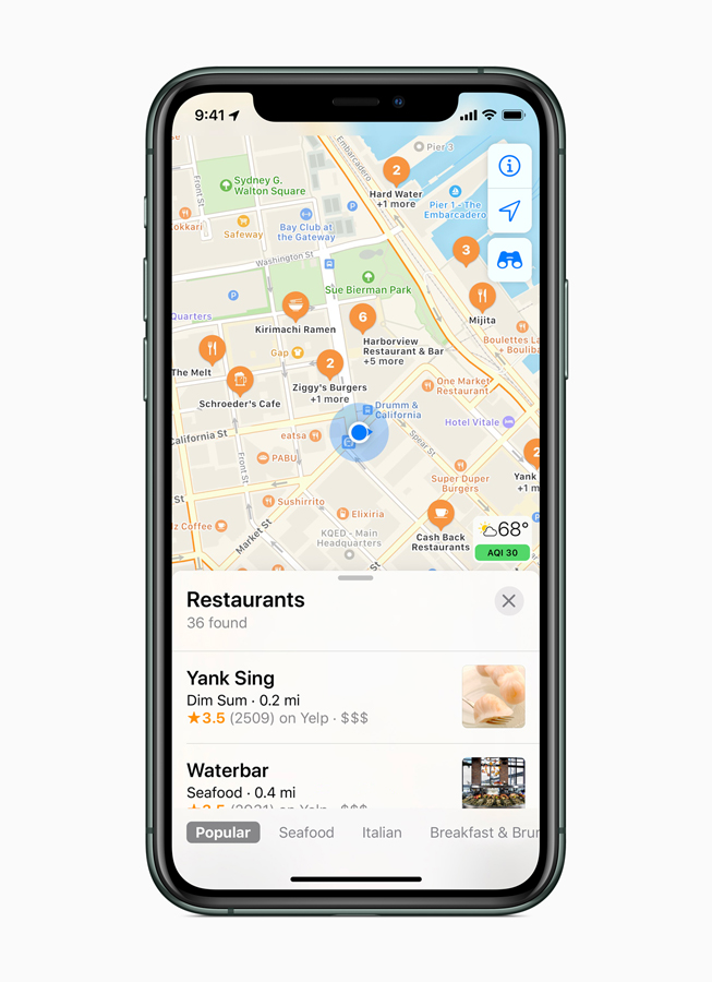
Apple Maps is Apple’s built-in navigation service for iPhones, iPads, Macs, and Apple Watches, launched in 2012 as a privacy-focused alternative to Google Maps. It offers turn-by-turn navigation for driving, walking, cycling, and public transport, along with real-time traffic updates, 3D city views, and augmented reality directions. Features like Flyover mode and Look Around provide interactive 3D and street-level imagery.
Apple Maps prioritizes user privacy, processing most data on-device without tracking location history. Over the years, Apple has enhanced its map accuracy, adding detailed landmarks, roads, and public transport information, making it a reliable choice for seamless and secure navigation.
Key Features:
- Real-time traffic and transit information
- Integration with iOS, macOS, and Apple CarPlay
- Privacy-focused, with minimal data collection
- Stunning 3D views and augmented reality directions
Why Choose Apple Maps?
If you own an iPhone, iPad, or Mac, Apple Maps provides a smooth and private navigation experience without Google’s extensive data tracking.
Acoustic Maps to Aid the Blind
3. HERE WeGo – Best for Offline Navigation
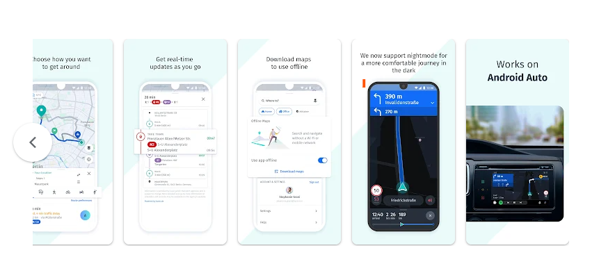
HERE WeGo is a free navigation and mapping service designed for drivers, cyclists, and public transit users. Originally developed by Nokia, it provides turn-by-turn voice guidance, real-time traffic updates, and extensive offline maps for over 100 countries. Unlike Google Maps, HERE WeGo allows users to download entire regions or countries, making it ideal for offline navigation.
One of its standout features is its detailed public transportation guidance, offering route options for buses, trains, and ride-sharing services. HERE WeGo also emphasizes privacy by minimizing data tracking. With its reliable offline capabilities and accurate directions, it is a strong alternative for travelers looking for a comprehensive mapping solution without relying on Google’s ecosystem.
Key Features:
- Full offline maps for over 100 countries
- Turn-by-turn voice navigation
- Public transport and rideshare integrations
- No Google tracking or data collection
Why Choose HERE WeGo?
If you frequently travel to areas with poor internet connectivity, HERE WeGo is an excellent option for offline navigation.
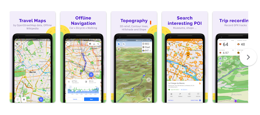
4. Maps.me – Lightweight and Ideal for Travelers

Maps.me is a free, offline mapping and navigation app designed for travelers, hikers, and outdoor enthusiasts. Built on OpenStreetMap (OSM) data, it allows users to download full maps of cities, regions, or even entire countries for offline use, making it ideal for navigating without an internet connection. It offers turn-by-turn navigation for driving, walking, and cycling, along with points of interest, hiking trails, and local attractions.
One of Maps.me’s key strengths is its lightweight design and fast performance, ensuring smooth navigation even on low-end devices. It also supports user-contributed updates, ensuring map accuracy. Unlike Google Maps, Maps.me does not heavily track user data, making it a more privacy-friendly alternative for those seeking a reliable, offline-first mapping solution.
Key Features:
- Full offline access to maps worldwide
- Free travel guides and recommendations
- Walking, cycling, and driving navigation
- OpenStreetMap-based with frequent updates
Why Choose Maps.me?
If you need a compact, offline-friendly mapping app that works well for both city navigation and outdoor adventures, Maps.me is an ideal pick.
5. Waze – Best for Real-Time Traffic Updates
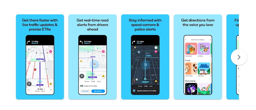
Waze is a community-driven navigation app that provides real-time traffic updates, road hazard alerts, and the fastest route suggestions based on live user reports. Acquired by Google in 2013, Waze relies on crowdsourced data from millions of drivers to detect traffic jams, accidents, speed cameras, and road closures, helping users avoid delays. It also offers voice-guided navigation, estimated arrival times, and integration with music and podcast apps.
Unlike traditional mapping apps, Waze focuses on dynamic, real-time navigation rather than detailed geographic data. It is especially popular among drivers looking for the quickest routes and up-to-the-minute road conditions. However, it requires an internet connection and collects location data to improve traffic insights, making it a more interactive but less privacy-focused alternative to other navigation apps.
Key Features:
- Community-reported traffic, accidents, and speed traps
- Fastest navigation routes based on real-time conditions
- Integration with music streaming apps
- Voice-guided navigation with multiple voice options
Why Choose Waze?
If you drive frequently and need real-time traffic updates, Waze is an excellent alternative that prioritizes efficiency over extensive mapping details.
6. Sygic – Premium Navigation with High-Quality Maps
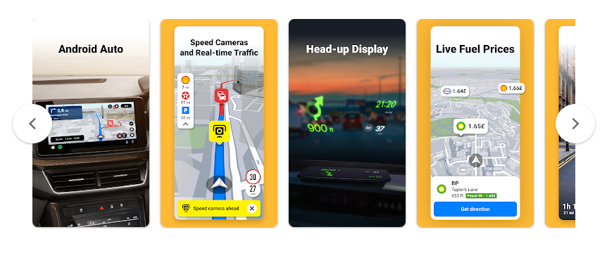
Sygic is a GPS navigation app known for its high-quality offline maps and advanced features. It provides turn-by-turn voice guidance, real-time traffic updates, and points of interest, making it a popular choice for travelers and drivers. Powered by TomTom maps, Sygic allows users to download entire countries or regions for offline use, ensuring reliable navigation without an internet connection.
One of Sygic’s standout features is its safety-focused driving tools, including speed limit warnings, lane guidance, and dashcam functionality. It also offers 3D maps, head-up display (HUD) mode, and integration with Apple CarPlay and Android Auto. While Sygic offers a free version, premium features like real-time traffic and advanced voice navigation require a paid subscription. Its offline capability and feature-rich experience make it a strong alternative to Google Maps for both everyday drivers and frequent travelers.
Key Features:
- High-quality 3D maps available offline
- Turn-by-turn voice navigation
- Speed camera alerts and real-time traffic updates
- Advanced lane guidance for better navigation
Why Choose Sygic?
For those willing to invest in a premium navigation experience with high-quality offline maps and advanced driving features, Sygic is an excellent choice.
7. Citymapper – Best for Public Transport Users
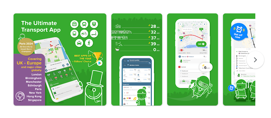
Citymapper is a smart public transportation app designed to help users navigate cities efficiently using buses, trains, subways, ferries, and even bike-sharing services. Known for its real-time transit updates and multimodal route planning, Citymapper provides accurate arrival times, step-by-step navigation, and alerts for delays or disruptions.
Unlike traditional mapping apps, Citymapper focuses on urban mobility, offering features like smart route comparisons, cost estimates, and integration with ride-hailing services like Uber. It also includes offline maps and turn-by-turn walking directions for first-mile and last-mile connectivity. Available in major cities worldwide, Citymapper is an ideal choice for commuters and travelers looking for a seamless, data-driven transit experience.
Key Features:
- Real-time public transport schedules
- Multi-modal navigation (bike, subway, bus, walking)
- Smart route planning with estimated arrival times
- Integration with ride-hailing services like Uber and Lyft
Why Choose Citymapper?
If you live in or frequently travel to large cities, Citymapper is one of the best Google Maps alternatives for public transportation planning.
Why You Might Want to Switch from Google Maps
Google Maps is an excellent navigation tool, but there are several reasons why users seek alternatives:
- Privacy Concerns – Google collects vast amounts of user data, including location history and search behavior. If you prioritize privacy, alternatives like OpenStreetMap and Apple Maps are better choices.
- Offline Navigation – While Google Maps allows some offline functionality, apps like HERE WeGo and Maps.me offer more comprehensive offline access.
- Better Specialized Features – If you’re looking for real-time traffic updates, Waze is superior. If you need public transit guidance, Citymapper is more detailed.
- Reduced Google Dependence – Some users prefer to avoid Google’s ecosystem for ethical, privacy, or personal reasons.
Final Thoughts
While Google Maps remains a powerful and convenient navigation tool, there are numerous Google Maps alternatives that cater to different user needs. Whether you prioritize privacy, offline navigation, real-time traffic updates, or public transportation planning, there’s an option for you.
Exploring alternatives like OpenStreetMap, Apple Maps, HERE WeGo, Waze, and Citymapper can help you find a navigation app that aligns better with your lifestyle and privacy preferences. With so many choices available, you no longer have to rely solely on Google for your mapping needs!